Deprecated: Function WP_Dependencies->add_data() was called with an argument that is deprecated since version 6.9.0! IE conditional comments are ignored by all supported browsers. in /chroot/home/a1e0f025/dab19c68f8.nxcli.io/html/wp-includes/functions.php on line 6131 Deprecated: Function WP_Dependencies->add_data() was called with an argument that is deprecated since version 6.9.0! IE conditional comments are ignored by all supported browsers. in /chroot/home/a1e0f025/dab19c68f8.nxcli.io/html/wp-includes/functions.php on line 6131

Last Weeks in the Galápagos

Time was running short on our stay in the Galápagos – there was only one more 3-week class ahead of us, and after that, for legal reasons (the government is very strict about how long foreigners or even mainland Ecuadorians can stay on the islands), we would have to leave pretty much immediately.

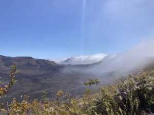
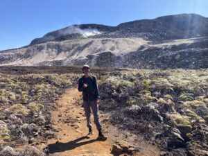
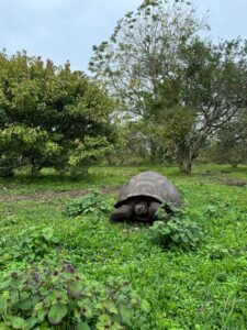
Our final class was focused on plants in the Galápagos, with a focus on the relations between native and invasive species. Due to the Galápagos’ remoteness, much like my home state of Hawai’i, its native wildlife has evolved on its own separate from the rest of the world. As such, this was a pretty interesting class subject for me, although I personally was a little disappointed at its relative lack of field work compared to the other classes where we made trips to other islands.

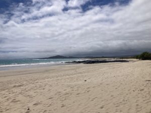
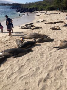
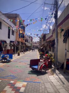
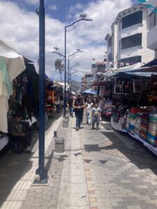
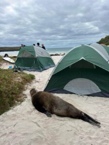
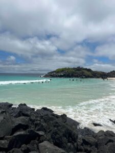
Outside of class, we did our best to make the most of our remaining time in the islands. After learning that camping permits were pretty cheap and easy to acquire, we decided to go camping at Puerto Chino, a beach on the south shore and the farthest (and nicest) beach that could be accessed without having to take a boat.

A sea lion sleeping next to tents set up on a beach.
Staying at Puerto Chino.
A sandy bay with people surfing.
Staying at Puerto Chino.

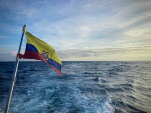
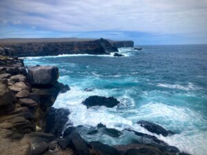
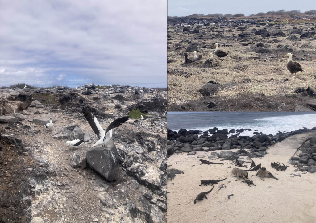
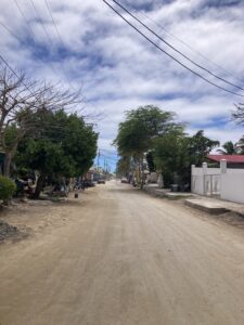
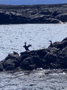
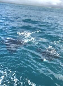
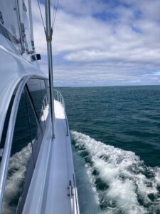
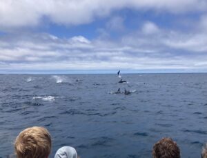
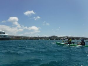
We also did what is called a “360” on San Cristóbal, essentially taking a boat all the way around the island and visiting various spots along the way, including Kicker Rock, a famous snorkeling and diving spot, and Punta Pitt, the easternmost point of the Galápagos. There, we got lucky enough to see a massive dolphin pod! The size of it was genuinely like nothing I had seen before, with probably at least a hundred dolphins if not more – that moment was one of the most standout points of the semester. We spent the rest of our time hanging around town and at the beaches, making the best of the time we had left, including renting some kayaks and paddling around Puerto Baquerizo Moreno.

People watching dolphins jump out of the ocean.
Dolphins at Punta Pitt and kayaking in the harbor.
Two people kayaking in a harbor.
Kayaking in the harbor.

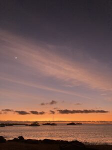
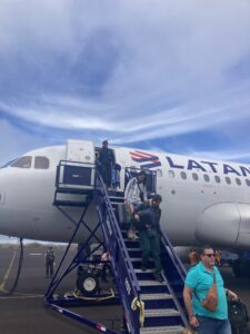
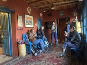
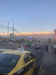
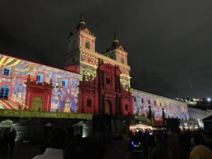
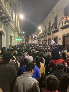
But before we knew it, the weeks flew by and it was time to leave. It was difficult especially since we were all leaving at different times to go on our way, so we had to say goodbye to each other basically one at a time. It wasn’t long before I found myself back at the airport in Quito for the long trip home, but the experiences I had in Ecuador and the Galápagos will stay with me forever.

People standing for a photo at the airport saying goodbye.Friends saying good by at the airport.

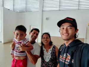
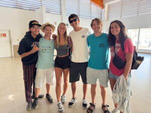
Goodbyes at the airport.
Kai

Field Ecology

After our mid-semester break, we started on our second-to-last course, Field Ecology. As someone with past experience in field research and who wants to continue doing it in the future, I was looking forward to this course, and it did not disappoint. On our first week, we spent the day on a field excursion to the island of Española, located almost directly south of San Cristóbal. As it is about the same distance as Santa Cruz, it was about a 2-hour boat ride to reach the island through fairly rough seas, although thankfully the water had calmed by the time we reached the island.

An Ecuadorian flag flying off the stern of a boat.

Sailing to Española.

Compared to the three other ‘major’ islands we had visited so far – San Cristóbal, Santa Cruz, and Isabela – Española was considerably smaller (37 square miles – less than a quarter of the size of the already-small San Cristóbal!) and had no human population. However, it is best known for its status as one of if not the only breeding sites of the waved albatross, which makes it a popular location for seabird enthusiasts.

Cliffsides along the coast of Espanola, Galapagos.

Rocky cliffs on the south shore of Española. Apart from these, the island is extremely flat and barren as can be seen in the distance.

We spent some time first snorkeling near the northern part of the island at a point known as Gardner Bay before landing on the island itself at Punta Suarez, on the island’s western tip, to observe the local wildlife, which included the albatrosses as well as several other seabirds, in addition to sea lions and marine iguanas, unique among lizards for their swimming and diving abilities.

A small collage of wildlife seen in the Galapagos.

Top left clockwise: waved albatross, sea lion pups among marine iguanas, and Nazca boobies.

The second and third weeks of the class were focused on a local study on San Cristóbal that focused on incidences of bird roadkill on the island’s main road. As a part of this study, we had to go out several times and basically search for and collect (in a sanitary manner, of course!) dead birds along the side of the road.

A group of students standing by the road in reflective gear doing bird sampling.

Bird sampling along the road.

Definitely morbid and unpleasant work, but that’s simply what the project entails sometimes – when, in this case, you need to know how many birds are getting killed on the road within a certain period, well, the only way to really find that out is to go out and see. So while it was definitely not anyone’s idea of a good time, I think it was a useful project to get us used to the idea that not all field science is necessarily “fun” work – this tied into other elements of the class that discussed field research and science from an ethical perspective, which I think was also a very interesting discussion to have that opened up new perspectives on how field research should be conducted.

Kai

Break in the Galápagos

After the end of our Island Biogeography course, we had a one-week mid-semester break to round out our first month in the Galápagos. Although we had visited Santa Cruz before as part of our previous class, many of us wanted to explore more of the other islands in the Galápagos, so we decided to spend most of the week away from San Cristóbal.

Since we had been to Santa Cruz before, we decided to make our main objective the island of Isabela. The largest island on the Galápagos, but only the 3rd most populated, Isabela is known for its tall volcanoes and unique wildlife. To get there, we had to travel by boat again via Santa Cruz, and between the boat rides and a 4-hour “layover” in Santa Cruz, it took the whole day to reach the island.

The main town on Isabela, Puerto Villamil, was much smaller and less developed than the other ‘main towns’ of the islands we had visited.  It had just a few paved roads and the rest being either made from brick or even just dirt and sand. For the first day, we went up to the highlands and hiked in the crater of Volcán Sierra Negra, where we saw active sulfur deposits. It was a very different change of scenery compared to the rest of the Galápagos, reminding me somewhat more of the Andes that we had spent time in on the mainland.

A large volcanic crater with clouds creeping over the rim.The author in a large volcanic crater.

Hiking Sierra Negra.

We spent our second and third days on Isabela, mostly around town, surfing some waves by the beach and biking along the coast to the Wall of Tears.  This was a remnant of the Galápagos’ past as a prison colony where prisoners were forced to build a wall by hand in a cruel act of pointless labor.

A sand street in Puerto Vilamil, Isabela, Galapagos.A long beach on Isabela, Galapagos.

The streets of Puerto Ayora, and one of the beaches where we surfed.

On our fourth day, a few of us decided to take a boat tour to see more of the island. Like all islands of the Galápagos, only a tiny fraction of Isabela is accessible by car and as such, if you want to see other parts of the island you need to take a boat. We decided to travel around the southwestern coast, which would allow us to see a wide variety of marine and terrestrial life on and around Isabela.

Flightless cormorants drying their wings in the Galapagos.Manta rays just below the surface of the water out in the ocean.

Some flightless cormorants and manta rays west of Isabela.

Over the course of the day-long trip, we traveled along the coast, stopping at various points to go onshore or go snorkeling.  We saw a huge variety of life – among the highlights were orcas, manta rays, Galápagos penguins, flightless cormorants, several sharks, and seahorses!

On the fifth day of our break, we returned to Santa Cruz.  We spent two more days there, exploring the island and Puerto Ayora a little further, before heading back to San Cristobal to spend the weekend relaxing before our next class started off.

Kai

To Santa Cruz

Adjusting to life on the Galápagos can be a little difficult at first. Quito is a massive city with tons of things to do and places to see, while within a few days on San Cristóbal you will have seen everything you possibly can within walking distance of Puerto Baquerizo Moreno. To some people this might feel stifling or trapping, but I personally enjoyed the change of pace. Besides, we also had our classes to keep us busy.

A sunset at Playa Mann on San Cristóbal, Galápagos.
The streets and sunsets of Puerto Baquerizo Moreno, San Cristóbal.

A street in Puerto Baquerizo Moreno, San Cristóbal, Galapagos.

Our first course in the Galápagos was Island Biogeography, focused on the mechanics of island formation and how an island’s location and geography affect the species that move to and evolve on it. The Galápagos, with its extensive list of endemic species (‘endemic’ meaning that it is only found in a single area, in this case the Galápagos), is a prime location for learning these concepts. Our knowledge was also augmented by extensive field studies. Our first major one was a 3-day trip to the nearby island of Santa Cruz.

Santa Cruz is the most populated island on the Galápagos, with 15,000 people, and as such, it is generally considered the ‘main’ island, at least for tourism operations. To get there from San Cristobal, you must take a 2-hour ‘water taxi’; while I personally never have much trouble with boats, the high speed and rough seas were an issue for more seasick-prone people.

A Galápagos giant tortoise in the El Chato highlands of Santa Cruz, Galápagos.
A Galápagos giant tortoise in the Santa Cruz highlands. This one was probably about 2 and a half feet tall!

Once on Santa Cruz, we spent the first day on the southern half of the island, visiting a tortoise sanctuary and a highland preserve to get a better understanding of the Galápagos’ famous giant tortoises, and how they serve an important role in the Galápagos’ terrestrial ecosystems.

The second day was focused more on the aquatic environment; we traveled to the northern end of the island and spent the day on a boat to North Seymour Island, a small island (less than 1 square mile in size!) just north of Santa Cruz. There, we took a snorkeling trip to see the local marine wildlife and took a small hike on North Seymour to observe the nests of various seabirds like the blue-footed booby and magnificent frigatebird.

The view off a speedboat in the Pacific Ocean.
Sailing to North Seymour, off the coast of Santa Cruz.

The rest of the second day and the first half of the third day, we essentially had to ourselves to explore Santa Cruz’s main town of Puerto Ayora. It was a significantly larger town than Puerto Baquerizo Moreno, with more shops, restaurants, and hotels, but definitely felt more ‘touristy’ than San Cristóbal did.  However, having spent a couple weeks on San Cristóbal at this point, it was good to get a feel for a different island in the archipelago.  Plus, the tourist aspect gave us a good opportunity to buy souvenirs!

Kai

Arrival in the Galápagos

After seven weeks on the Ecuadorian mainland, it was finally time for us to transfer to the Galápagos, where we would spend the remaining ten weeks of the semester. USFQ’s Galápagos campus is located on the island of San Cristóbal, the second most populous island in the archipelago. To get there, we took a flight from Quito direct to San Cristóbal with a short stopover in Guayaquil to pick up some additional passengers.

Disembarking a plane in the Galapagos

Disembarking at San Cristóbal.

My first impressions of the Galápagos, upon arrival, reminded me in some ways of the arid parts of Hawai’i, where I grew up and still live; the mix of low, dry vegetation with rocky shores and sandy beaches was similar to parts of O’ahu in the dry summers. However, there were two major differences that were immediately apparent; first, the lack of mountains and second, the extent of human habitation.

San Cristobal is estimated to have a population of around 7,000 people, the vast majority of whom live in a single town, Puerto Baquerizo Moreno. While that might still sound like a lot of people, consider that McMinnville has a population of around 35,000. So Mac – which most people probably wouldn’t consider to be a very large town – has around five times as many people as the entirety of San Cristóbal!

The harbor at Isla San Cristobal
The bay of Puerto Baquerizo Moreno. Most of the town is visible from here.

Obviously, though, this is to be expected – after all, the Galápagos is famous not for any big towns and crowds but rather for its wildlife and natural environment. And indeed this was also evident; for instance, we encountered sea lions almost immediately after arriving, laying about on the beaches and even in the streets in parts of town close to the shore. While I’ve seen seals and sea lions in the wild before, the sheer number that were sprawled out on the beach was shocking.

Sea lions sleeping on a beach
Sea lions lounging on the beach at Playa Mann, right next to campus.

The USFQ campus is located on the northern end of town, right in front of Playa Mann, the town’s main beach. Like in Quito, we all lived with local host families; this time, I lived with a family of four. The environment there was really different from my host experience in Quito, but it wasn’t a bad change. While we had the weekend to re-orient to life on the islands, when Monday came around, we went right back to work to take our first Galápagos classes.

Kai

The Ecuadorian Páramo

After our week in the Amazon, our Tropical Ecology course shifted focus from the Amazon rain forest to the mountainous highlands that surrounded Quito. While this cold, grassy environment might not be the first thing you think of when you hear “tropical”, since they are in the tropics regardless, they can still be considered a tropical environment.

The highlands of the northern Andes are known as the páramo, and are classified by low shrubs and grasses, high winds, and fluctuating temperatures, much like many other mountainous environments around the world. Much like with the Amazon, our understanding of this environment was deepened by a long field study, although this one was only three days, quite a bit shorter than the almost week-long Amazon trip.

The Ecuadorian highlands, with Rumiñahui in the background.
A shot of Cotopaxi in the Ecuadorian highlands.

During this trip, we were based out of a mountain lodge on the slopes of Rumiñahui, a small mountain just north of the Cotopaxi volcano, arguably Ecuador’s most famous mountain. It was an older but very cozy place, and stayed nice and warm during the nights, when the temperatures would sometimes drop below freezing due to the altitude, dry climate, and high winds. Our fieldwork on-site consisted of soil sampling and observational work, using soil nutrient and chemical analysis devices to determine the quality and water-carrying capacity of the soil; the soils of the South American páramos also function as massive water reservoirs, meaning that they are extremely important to not only Ecuador’s natural ecosystems but its human residents as well. We also spent a lot of time hiking around the nearby mountains and identifying local plant and animal species so as to better understand these mountain ecosystems.

Our survey group getting ready to conduct fieldwork.
Field survey equipment for soil sampling in action.

Overall, while the páramo trip might not sound quite as exciting as our week in the Amazon, I personally found it to be really interesting and enjoyable, with a lot of time to ourselves to explore this area of the Ecuadorian Andes on our own terms in addition to our class activities. However, our time in the mainland was coming to an end; soon, we would be transferring to the USFQ’s Galápagos campus, where we would be spending the rest of the semester.

While it was a shame to be leaving soon, the prospect of going to the Galápagos – the location this program is focused on, after all – was extremely exciting to all of us.

Kai

Into the Amazon

Our second main course was focused on Tropical Ecology, and our new professor’s approach was a very hands-on.  In his opinion, the best way to study a complex tropical ecosystem like the Ecuadorian Amazon, was to go there ourselves and observe it in-person. So that was exactly what we did – spending five days deep in the Amazon rainforest, miles and miles from any major city. It was so isolated that even reaching our field station took an entire day!

Our journey began at the Quito airport, where we took a 2-hour flight over the eastern cordillera of the Andes to a city known as Coca. From there, we embarked on a small motorboat that took us about 40 kilometers down the Río Napo.  Due to a drought in the area, our captain had to navigate shallow waters that made the journey take an additional two hours. We then disembarked at an oil drilling company’s base camp. Oil drilling is a major subject of debate in the Amazon, as it is a big part of Ecuador’s economy, but is obviously very destructive to the environment.

From the oil company camp, we rode by bus, which took us down an access road for another 50 kilometers and 2 hours (the road was unpaved and very windy) through the jungle.   We then took yet another motorboat which took us the last 50 kilometers down the Río Tiputini to USFQ’s Tiputini Biodiversity Station, 3 hours later. After a full dawn-to-dusk day, we arrived at our destination. There was no road, settlement, or infrastructure for miles.  Coca, the nearest major town, was now over 60 miles away.

Our field station in the dark of night.
 Our field station at nighttime.
Traveling by boat down the Tiputini River.
Traveling down the Tiputini River by boat.

The next day, we went into the jungle. We spent the first day hiking and simply observing the incredible jungle, to get accustomed to the terrain, climate, and wildlife. As someone who grew up hiking in the jungles of Hawai’i, I thought I knew humidity, but nothing compares to the Amazon. It was so bad that during our downtime, we would turn on the generator and sit in the lab, the only building with A/C, for hours.

The dense jungle foliage and multitude of dangerous spiders and insects were also a cause for concern, making hikes generally a strenuous experience. However, it was well worth it in the sheer variety of wildlife we saw – from tropical birds like macaws and the hoatzin to simians like the squirrel monkey and golden-mantled tamarin to aquatic mammals like the capybara and giant river otter. We even found prints from a jaguar, but never saw the animal itself. And, of course, there were countless insects from giant centipedes to the infamous bullet ant.

A collage of many animals in the Amazon.

A small (blurry) collage, moving clockwise: a white-throated toucan, jaguar print, giant toad, capybara, tarantula, and howler monkey.

Our later days were focused on interactions between indigenous peoples living in the Amazon and the “outside world”. Many of the Amazonian tribes have only recently been connected to the industrial world (two tribes even remain uncontacted), which has led to many negative interactions with Ecuadorians. These range from personal disputes between tribespeople and outsider hunters and fishermen to manipulative contracts and agreements made by oil companies to allow drilling on tribal territory, with little given in return. To further augment our understanding of the local peoples in the area, we visited a nearby indigenous village that had been connected by a road about 10 years prior.

The view of the foliage-covered hillside from a treetop in the Amazon.
The view from a treetop in the Amazon.
A trail in the Amazon covered by lots of trees and plants.
A trail in the Amazon.

At the end of our stay, we had a lot of time to reflect on our experience during the long journey back home. While we were only in the Amazon for about five or six days, it was genuinely a life changing experience that will stick with all of us for a long time.

Kai

Quito Surroundings

In the second week of our GIS class, Geographic Information Systems and Science, we had our first field study!  As someone who picked out my Environmental Studies degree because of my positive experiences with conducting field work, I was looking forward to getting out there and getting our hands dirty.

This first trip was to the Mindo cloud forest, a highland jungle area northwest of Quito. Because of the difficult mountain terrain around Quito, we had to take a roundabout way to the north to reach Mindo, but once we arrived we were blown away. Compared to Quito’s dry arid grasslands, the jungles of Mindo were a completely different world. We spent three days there in total, staying in the Bellavista Lodge, which was a super nice place with a really cool room layout where you used a central ladder to access the different floors with each floor being its own “room”.

We spent most of the time hiking and logging points on GPS units to upload and work with later on, but we also had plenty of time to explore the area on our own time.

A photo of me walking through a field, holding a GPS unit.
Myself,  conducting some field work.
The view of a sunrise coming over the Mindo valley.
The morning sunrise in Mindo.

One of the biggest things about Mindo was its great diversity of wildlife, so we kept our eyes peeled for various jungle animals and we were not disappointed. We spotted several mammals, including a couple tayras – omnivorous animals related to weasels and wolverines – and a kinkajou, which is a tree-climbing animal that kind of looks like a lemur at first glance but is actually closer related to raccoons.

The most common and diverse animals we saw, however, were easily the birds. There were a wide array of tropical birds including toucans, trogons, and lots of hummingbirds. The hummingbirds, especially, were so unafraid of humans that if you held a cup of sugar water, they would just land on your hand to drink it!

Hummingbirds drinking from a cup in my hand.
Some hummingbirds on my hand in Mindo.

Some hummingbirds on my hand in Mindo.

My friends and I also would make our own trips to the surrounding areas outside of class. We took advantage of one three-day weekend to go down south and visit Baños, a famous tourist town located in a low river valley that led into the Amazon jungle.  As a result, like Mindo, it was a much more tropical environment than Quito’s highlands and had a variety of things for visitors to see and do.

One of the biggest surprises to us was how inexpensive everything was – while we had expected a big touristy destination like Baños to be expensive, it was actually very affordable – our lodging, for example, was a hostel that cost less than $10 per night which was surprising, considering how nice the premises were.

Me sitting by a waterfall in the mountains with a dog.
Hiking in Baños

Overall, the start of this second month in Ecuador was filled with a lot of travel and adventure in a welcome change of scenery from the mountainous dry terrain of Quito. However, the real adventure is yet to come – the next course, focused on tropical ecology, will feature a week-long trip to the heart of the Amazon Rainforest.

Kai

Life in Quito

After one week of Spanish classes, the “true” classes for our program in Ecuador began. While the Spanish classes had taken place the week before the official start of the semester, when we showed up to campus the next week it was completely packed! As someone in the ecology and evolution track, my first class was focused on Geographical Information Systems (GIS), a computer program that allows one to display and analyze data on maps for data visualization. It’s not an easy program to learn, but thankfully I had actually taken a GIS course at Linfield about 2 years prior so I was already familiar with the basics.

However, there’s more to a study abroad program than just going to class, and our group (there were 22 of us in total, across both my track and the other track, which was focused on marine ecology) made sure to make the most of our time in Quito outside of class and over the weekends.

One of the first highlights of the trip for me was a climb up Rucu Pichincha, a 4,700-meter (15,400-foot) peak located immediately west of Quito. We accessed the trailhead by a cable car and proceeded to hike towards the peak. Fifteen thousand feet of elevation is no joke.  Even though the trail itself was never particularly steep, the thin air wore us out quickly and 5 of the 8 people in our group ended up turning around before the peak. But the three of us who did make it up to the top were treated to a great view of not only Quito but also the mountains on the other side of Rucu Pichincha.

A view of the city of Quito from halfway up Rucu Pichincha. The Cotopaxi volcano is visible in the background.

A view of the mountains west of Rucu Pichincha from the summit. Sharp dramatic mountains rise up out of the valleys covered in clouds below.

The view of Quito from partway up the trail with Cotopaxi in the background (left), and the view to the west from near the summit of Rucu Pichincha, at about 15,000 feet.

We also traveled a short distance to visit the town of Otavalo, located about 2 hours or so north of Quito. A vibrant center of the traditional lands of the indigenous Otavalo Kichwa people, Otavalo is famed for its Saturday market.  On busy days, the market can spread across a third of the city and is claimed to be the largest artisan market in South America. It certainly felt like it, as the stalls seemed to stretch on forever, no matter where you went.  People were selling various goods ranging from basic souvenirs to handicraft jewelry and clothing, to expensive artisan sculptures and art pieces. You’d be hard-pressed to not find anything you were looking for there.

A small street in the town of Otavalo. The street is paved with colored bricks and many flags hang across the street from the rooftops above.A street in the town of Otavalo in the main square. The path is crowded and lined with many market stalls.

The streets of Otavalo during the Saturday market, around the outskirts of the stalls (left) and in the central square (right).

Overall, I feel I am beginning to settle well into Ecuadorian life. The food is excellent, the people are nothing but kind and friendly, transport is cheap and easy to find, and the university is a vibrant campus with lots of student life. What more could you possibly ask for?

Kai

First Days in Ecuador

After more or less a full 24 hours flying from Honolulu to Los Angeles, then Panama City, and finally Quito, I have finally arrived in Ecuador!

Flying into Quito, with it's green tree-covered hills.

The approach into Quito

The Galapagos program, which I am participating in, is structured very differently from a typical study abroad program.  Taking classes like any other student, we pick a “track” with a focus on a specific subject (mine, for instance, is focused on ecology and evolution). Each track includes five intensive three-week-long courses, taken one at a time with three hours of class a day.

Basically, it’s like five Jan Term classes all strung together. In addition, since the university here in Ecuador (Universidad San Francisco de Quito, or USFQ) doesn’t have any student housing, we don’t live in dorms or apartments but with host families who the university assigns us to.

In any case, my host mother picked me up from the airport and drove me into town. Host families seem to vary pretty widely in terms of size, income, and location, although as far as I can tell most of them are in the same neighborhood as the university.

I was lucky enough to live quite literally a block away from campus, so it might as well have been campus housing!  My host mother lives alone but her children and grandchildren visit often, which I think is a good combination – you often meet other family members,  but can still have peace and quiet if you come home after a long day.

Having arrived on Friday, I had the weekend to get to know the area before orientation and classes began on Monday. The university is located in Cumbayá, a neighborhood located about 30 minutes from central Quito. One of the highest-income areas in the city, it is very safe and has many malls, stores, and restaurants as well as many gated neighborhoods.

A view of Cumbayá at yellow/orange colored sunset.

A view of Cumbayá at sunset

I had happened to arrive the day before Ecuador’s Independence Day, August 10th, so when Saturday came around my host mom took me with her relatives to observe the festivities. It was a good opportunity to see downtown Quito and try out the public transportation, although the streets were insanely packed.

The festivities of Ecuador's Independence Day in Quito's old town.The festivities of Ecuador's Independence Day in Quito's old town with people packing the streets.

The festivities of Ecuador’s Independence Day in Quito’s old town

After the weekend, classes and orientations began. While our courses were each three weeks long, our first week was a standalone Spanish course to ensure everyone could at least do some basic communication.  The classes were split based on the results of placement tests we took prior to arriving, so everyone was in a class that matched their skill level.

We also had several orientations concerned with the rules of the program and life in Quito. We were given a tour of the campus, which is probably a 10th of the size of Linfield, taking up about 1 and a half city blocks. Despite this, it has nearly 5 times as many students, so it is extremely densely packed!

Overall, though, it is a great campus in an exciting area, in my opinion, and I am excited to get to know it better!

– Kai